


Intense Rain and Flash Floods Expected from New York City to Washington, D.C., July 31–August 1, 2025. Authorities Issue Emergency Declarations and Urge Preparedness as Severe Storms Loom
A powerful storm system is set to bring intense rainfall and potential flash flooding across the U.S. East Coast, from New York City to Washington, D.C., starting Thursday afternoon, July 31, 2025, and continuing into Friday, August 1.
With rainfall rates up to 3 inches per hour and totals potentially reaching 5–8 inches in isolated areas, officials have issued urgent warnings, including a state of emergency in New Jersey and a travel advisory in New York City. Below is a comprehensive overview of the forecast, impacts, and preparations, drawing on the provided information and web sources, with a critical examination of the situation.
Forecast: Heavy Rain and Flash Flood Risks
The National Weather Service (NWS) forecasts 1.5–3 inches of rain across the region, with localized areas possibly seeing up to 5–8 inches, particularly in northern New Jersey, southeastern Pennsylvania, and the Washington, D.C.–Baltimore corridor. Rainfall rates could hit 3 inches per hour, especially during Thursday afternoon and evening, driven by a stalled frontal boundary and high atmospheric moisture.
The NWS has issued a Flood Watch for New York City, New Jersey, and parts of the Mid-Atlantic, with flash flood warnings already in effect for areas like the Poconos and southern New England, signaling imminent flooding risks.
The combination of saturated soil from recent storms—such as the July 14–15 deluge that dropped 6.67 inches in Clark, N.J., and 2.64 inches in Central Park—heightens the risk of flash floods, rock slides, and landslides. The NWS notes that urban areas along the I-95 corridor, including New York City, Philadelphia, Baltimore, and Washington, D.C., face significant disruptions due to poor drainage and overwhelmed infrastructure. A Level 2 out of 4 risk for excessive rainfall covers Delaware, Maryland, D.C., and parts of Virginia through Friday morning, with flash flooding likely during peak commute hours.
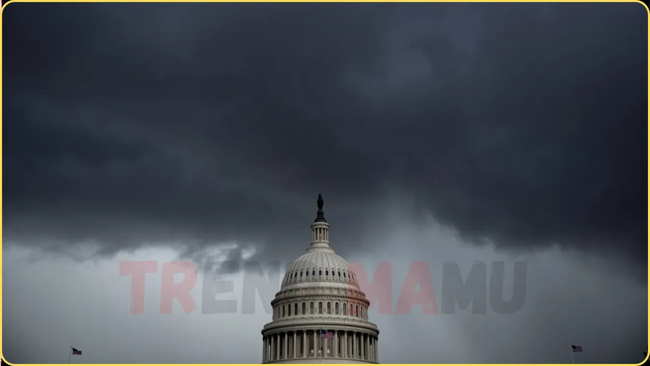
Emergency Declarations and Official Responses
New Jersey’s Acting Governor Tahesha Way declared a state of emergency effective 2 p.m. Thursday, July 31, citing the potential for flash flooding, severe thunderstorms, and damaging wind gusts. “Residents should remain off the roads and indoors unless absolutely necessary,” Way stated, emphasizing safety protocols and monitoring via trusted channels like Notify NYC. This follows a July 14 storm that killed two people in Plainfield, N.J., when their car was swept into Cedar Brook, highlighting the region’s vulnerability.
In New York City, Mayor Eric Adams issued a travel advisory for Thursday and Friday, urging residents to avoid travel and prepare flood prevention measures, such as clearing drains or moving vehicles to higher ground. “Be prepared for a serious storm,” Adams posted on social media.
NYC Emergency Management Commissioner Zach Iscol activated the Flash Flood Emergency Plan, warning of “intense rainfall rates and amounts in a very short period of time.” Residents in flood-prone areas, especially those in basement apartments, are advised to be ready to evacuate and sign up for Notify NYC alerts.
Washington, D.C., and Baltimore face similar risks, with the NWS forecasting up to 3 inches per hour in these areas. A severe thunderstorm watch, indicating potential for strong winds and hail, is in effect until 8 p.m. Thursday for D.C., Baltimore, Philadelphia, and New York City. Recent flooding on July 19 in Silver Spring, Md., where 5–5.5 inches fell in two hours, prompted a rare Flash Flood Emergency, underscoring the region’s susceptibility.
Recent Context and Infrastructure Challenges
The Northeast has faced a hyperactive flood season, with 3,040 flash flood warnings issued nationwide from January 1 to July 15, 2025, a record since 1986. Just two weeks ago, on July 14, New York City saw its second-highest hourly rainfall (2.07 inches), flooding subways and roads, while two deaths in New Jersey underscored the lethality of flash floods.

Montgomery County, Md., reported 100 flood-related calls on July 19, with Sligo Creek rising 10 feet in 30 minutes. These events, fueled by climate-driven increases in atmospheric moisture (7% more per 1°C warming), reveal infrastructure unprepared for extreme rainfall. New York City’s chief climate officer, Rohit Aggarwala, noted that aging sewer systems, designed for lighter precipitation, struggle with modern storms, with a $350 million Brooklyn sewer upgrade not due until 2033.
Critical Perspective
Official narratives emphasize preparedness, but the recurrence of deadly floods—four deaths in Plainfield, N.J., in July alone—raises questions about systemic failures. New Jersey’s tightened building regulations, announced July 14, were criticized by environmentalists as insufficient, and New York’s long-term infrastructure projects lag behind climate realities.
The focus on individual preparedness (e.g., avoiding flooded roads) may shift blame from authorities, as saturated soils and urban runoff amplify risks beyond personal control. The July 28 Detroit Metro Airport tunnel flooding, where Karen Humphrey drove through high water, highlights similar infrastructure vulnerabilities, suggesting a broader pattern of inadequate stormwater management across urban centers.
Safety Tips and Outlook
Avoid Travel: Stay off roads during heavy rain, especially Thursday evening. Never drive through flooded streets—6 inches of moving water can sweep vehicles away.
Prepare Now: Clear drains, move vehicles to higher ground, and charge devices. Basement apartment residents should know evacuation routes.
Stay Informed: Sign up for Notify NYC (nyc.gov/NotifyNYC) or follow @NotifyNYC for alerts. Monitor NWS updates at weather.gov.
Post-Storm Outlook: Rain should ease by Friday midday, with cooler temperatures (low 70s) and lower humidity by the weekend.
The storm system, fueled by warm ocean moisture, underscores the growing threat of climate-driven flooding. While no deaths have been reported for this event as of July 31, 2025, the potential for significant disruption remains high. If you need specific safety tips or updates for a particular area, let me know!